![Item #17070313 Colton's Traveler and Tourist's Guide-Book Through the Western States and Territories [Colton's Western Tourist and Emigrant's Guide]; Containing Brief Descriptions of Each, With the Routes and Distances on the Great Lines of Travel. Accompanied by a Map, Exhibiting the Township Lines of the U.S. Surveys, the Boundaries of Counties, Position of Cities, Villages, Settlements, Etc. Colton, oseph, utchins.](https://swansfinebooks.cdn.bibliopolis.com/pictures/17070313_1.jpg?width=768&height=1000&fit=bounds&auto=webp&v=1513818857)
![Colton's Traveler and Tourist's Guide-Book Through the Western States and Territories [Colton's Western Tourist and Emigrant's Guide]; Containing Brief Descriptions of Each, With the Routes and Distances on the Great Lines of Travel. Accompanied by a Map, Exhibiting the Township Lines of the U.S. Surveys, the Boundaries of Counties, Position of Cities, Villages, Settlements, Etc.](https://swansfinebooks.cdn.bibliopolis.com/pictures/17070313_2.jpg?auto=webp&v=1513818857)
![Colton's Traveler and Tourist's Guide-Book Through the Western States and Territories [Colton's Western Tourist and Emigrant's Guide]; Containing Brief Descriptions of Each, With the Routes and Distances on the Great Lines of Travel. Accompanied by a Map, Exhibiting the Township Lines of the U.S. Surveys, the Boundaries of Counties, Position of Cities, Villages, Settlements, Etc.](https://swansfinebooks.cdn.bibliopolis.com/pictures/17070313_3.jpg?auto=webp&v=1513818857)
![Colton's Traveler and Tourist's Guide-Book Through the Western States and Territories [Colton's Western Tourist and Emigrant's Guide]; Containing Brief Descriptions of Each, With the Routes and Distances on the Great Lines of Travel. Accompanied by a Map, Exhibiting the Township Lines of the U.S. Surveys, the Boundaries of Counties, Position of Cities, Villages, Settlements, Etc.](https://swansfinebooks.cdn.bibliopolis.com/pictures/17070313_4.jpg?auto=webp&v=1513818857)
![Colton's Traveler and Tourist's Guide-Book Through the Western States and Territories [Colton's Western Tourist and Emigrant's Guide]; Containing Brief Descriptions of Each, With the Routes and Distances on the Great Lines of Travel. Accompanied by a Map, Exhibiting the Township Lines of the U.S. Surveys, the Boundaries of Counties, Position of Cities, Villages, Settlements, Etc.](https://swansfinebooks.cdn.bibliopolis.com/pictures/17070313_5.jpg?auto=webp&v=1513818857)
![Colton's Traveler and Tourist's Guide-Book Through the Western States and Territories [Colton's Western Tourist and Emigrant's Guide]; Containing Brief Descriptions of Each, With the Routes and Distances on the Great Lines of Travel. Accompanied by a Map, Exhibiting the Township Lines of the U.S. Surveys, the Boundaries of Counties, Position of Cities, Villages, Settlements, Etc.](https://swansfinebooks.cdn.bibliopolis.com/pictures/17070313_6.jpg?auto=webp&v=1513818857)
Colton's Traveler and Tourist's Guide-Book Through the Western States and Territories [Colton's Western Tourist and Emigrant's Guide]; Containing Brief Descriptions of Each, With the Routes and Distances on the Great Lines of Travel. Accompanied by a Map, Exhibiting the Township Lines of the U.S. Surveys, the Boundaries of Counties, Position of Cities, Villages, Settlements, Etc.
New York: J.H. Colton and Company, 1856. Hardcover. Sixmo size, 137 pp. Near fine. Item #17070313
Joseph Hutchins Colton (1800-1893) founded the mapmaking company known as "J.H. Colton and Company", known internationally and highly regarded for the quality of their maps, which were printed using engraved steel plates and often hand-coloured, recognizable for their decorative borders. This volume is the 1856 printing of the guide book for what was then "the west", today what we would consider the middle of the country - Ohio, Michigan, Indiana, Illinois, Missouri, Iowa, Wisconsin, and the "territories" of Minesota (sic), Nebraska, and Kansas. A lovely copy in near fine condition, the map also near fine (see details below).
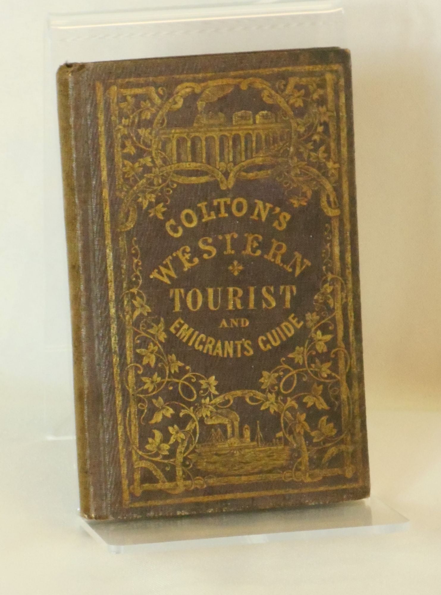
___DESCRIPTION: Bound in brown cloth with gilt lettering and lavishly decorated front board with gilt vignettes of a train on a high bridge and a steamship, all surrounded by an elaborate ruled border intertwined with vines, rear board blind stamped with the same decorations and lettering, spine blank, verso of title page lists copyright date as 1855, Davies & Roberts as Stereotypers (NY) and Pudney & Russell as Printers (NY); sixteenmo size (approximately 6" tall), pagination: [ii] blank, [1-2] title and copyright page, [3]-4 the "Publisher's Advertisement" (in reality an introduction to the book), 5-100, 1-36 publisher's ads, [2] blank, hand-coloured folding map tipped to rear paste down.
___CONDITION: Volume is in near fine condition overall, the binding is clean and unrubbed, the corners only gently bumped with minimal rubbing, the text block is strong and square with solid hinges, free of prior owner markings other than a name, and the title of the book, written in a vintage, flowing hand in pencil to the front free endpaper; the spine is sunned and lightly at the head and tail and there is some scattered foxing, else near fine. The map is also near fine, free of markings and with remarkably light wear, a few miniscule tears at the center folds and very light edgewear, else fine - the colours bright and fresh, firmly anchored to the rear pastedown. A wonderful example of this important early guide book.
___CITATION: Wright Howes Final C629.
___POSTAGE: International customers, please note that additional postage may apply as the standard does not always cover costs; please inquire for details.
___Swan's Fine Books is pleased to be a member of the ABAA, ILAB, and IOBA and we stand behind every book we sell. Please contact us with any questions you may have, we are here to help.
Price: $800.00